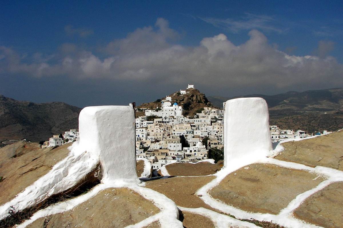
Ios tours bring travellers to a Cycladic island of white hill towns and sandy bays. For other routes, see our tours in Greece page.
This page covers what Ios tours include, how the island is reached from Piraeus, the white town of Chora, the beaches, the history of Ios, and how the trips combine with Santorini and Naxos.
What do Ios tours include?
Ios tours are boat trips, hikes and bike rides offered on the island by local operators. One outdoor-activity site lists 12 activities: three boat tours, five hikes, one bike tour and three water sports. A Greek listing site adds cruises and a trip to Sikinos.
Start with the boat trips, one group of Ios tours. The titles name a trip around seven beaches, a scenic trip from Mylopotas Beach and a snorkelling trip by speedboat. A Greek listing site adds a half-day cruise and a three-hour speedboat cruise along the coast. Each trip on the outdoor site names its own organiser.
The same Greek site lists private inflatable-boat cruises of four and of eight hours, with a maximum of 11 guests. It says a number of the island’s beaches can be reached only by boat. Snorkellers can see a variety of fish, and the site mentions a shipwreck to visit.
On land, Ios tours are hikes and one bike ride. Four of the five hikes start from Chora, and the fifth runs through it. The site rates them from easy walks to more moderate routes. The paths lead to Skarkos and to Gialos Beach and its lighthouse. One hike includes a cheese tasting. The bike ride goes to Homer’s tomb.
The outdoor site also lists a beginner’s windsurfing lesson and wakeboarding sessions in Mylopotas Bay, taught by local professionals. Ios tours come in two kinds, shared or private, the Greek site says. On a private tour you plan the route with the skipper, including places off the beaten track.
The Greek site lists a day trip to Sikinos with a winery visit, run for small groups. Wikipedia places Sikinos midway between Ios and Folegandros and calls it quiet and less developed than Ios. Its ancient name, Oinoe, meant Island of Wine. Browse our Ios photo gallery to see the island first.
How do Ios tours reach the island from Piraeus?
Ios tours begin after a ferry ride from Piraeus, the main harbour of Athens. Wikivoyage says ferry boats and high-speed catamarans run daily from Piraeus. It adds that Ios can also be reached from Santorini, Naxos and Heraklion.
Wikipedia describes Ios as an Aegean island of the Cyclades, set halfway between Naxos and Santorini. Ios belongs to the Thira regional unit. Wikipedia names Piraeus as the main seaport serving Athens. It lies on the Saronic Gulf and is Greece’s largest port. It has worked as Athens’s harbour since ancient times.
Wikipedia says ferries from Piraeus serve the Cyclades, Crete, the Dodecanese, the northern Aegean and the Saronic islands. Ios belongs to the Cyclades, so Ios tours start on that part of the ferry map. Athens Metro Line 1 ends at Piraeus, next to the port. The X96 express bus runs 24/7 between Athens International Airport and the harbour.
Piraeus is not the only gateway for Ios tours. Wikipedia calls the Parikia harbour on Paros a hub for Aegean ferries. It lists sailings to Piraeus, Naxos, Ios, Mykonos and Santorini. It gives the distance from Piraeus to Paros as about 150 kilometres. The Greek listing site also shows a full-day private boat cruise from Paros to Ios.
Ormos harbour has the Port of Ios at its northern end, says Wikipedia. It adds an organised marina and an adequate road network. Wikipedia says the way from the port to Chora, the main village, is a footpath up the hillside. Wikivoyage calls the direct way up a long stair and names the port village Ormos, also called Yialos.
Buses and cars take a longer, winding road, and in summer buses link the port, Chora and Mylopotas, says Wikivoyage. Taxi stations stand in Chora and in Yialos. Pickup and arrival times can change, so leave a margin when you plan Ios tours. Our general information about Ios covers the basics.
What do Ios tours show in Chora?
Ios tours show Chora, the main town on Ios, as a white village built between two small hills. Stairs lead up the hill, and a number of the paths can be reached only on foot.
In Greek, the name Chora simply means the main settlement. Wikipedia places the port at the north of Ormos harbour. From the port a footpath rises up the hill to Chora, according to the same article. Another article gives the elevation of Chora as 112 metres. Anyone on Ios tours that visit Chora arrives in a village above the harbour.
Wikipedia lists whitewashed buildings, narrow alleys and steep stairs, which leave the village largely closed to cars. A second article adds buildings covered in white lime, with sea-blue doors and window frames. Ground floors hold souvenir shops, cafés and restaurants, and residents live on the upper floors. Wikipedia counts 1,957 residents in Chora, the largest settlement on Ios.
The village counts at least 24 small churches. Wikipedia names Panagia Gremiotissa, the Panagia of the Cliff, among them. Under the modern town lie the remains of the ancient city-state of Ios. A walk on Ios tours through Chora crosses ground that was already a city in ancient times.
Along the central path, Wikipedia lists restaurants, boutiques, bars and discothèques that cater to visitors. The same article says that since the nineteen-nineties the island has tried to attract more than one kind of visitor. It names a scenic amphitheatre high on the village hill among the new works. European Community funds supported those works, including new paved roads.
One outdoor-activity site lists a historical hike through Chora among its walking tours. It also lists an easy hike from Chora to Gialos Beach and the lighthouse of Ios. Another listing pairs a hike from Chora with cheese tasting at a cheesery. Ios tours on foot suit a village made of stairs and footpaths.
Which beaches do Ios tours stop at?
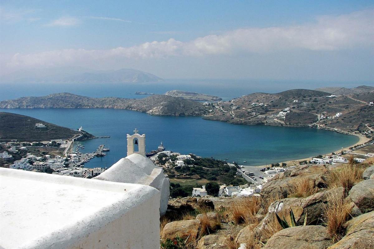
Ios tours by boat can leave from Mylopotas Beach, which is the biggest beach on Ios. One activity site lists trips to seven beaches, and Wikipedia names Manganari in the south of the island.
Wikipedia calls the beach of Mylopotas the largest on Ios in area and in length. It is an organized beach, less than 40 metres from the settlement’s restaurants and cafés. The settlement has 151 residents, and tourists visit it in summer. A stream that begins at the Mills of Chora gave the settlement its name.
Boat trips on Ios tours follow a coast that Wikipedia measures at 86 kilometres. About 32 kilometres of it is sandy beach, a little over a third of the coast. The article places small clusters of houses behind Theodoti, Kalamos and Manganari, which it calls the main beaches. Manganari lies in the south of the island.
One tour site notes that a number of beaches on Ios are reachable only by boat. It also mentions snorkelling, with fish to see and a chance to visit a shipwreck. The same site lists a half-day speedboat cruise to explore the coastline and swim. Trips are shared or private, and private groups can discuss the route with the skipper.
Another activity site lists a snorkelling speed-boat excursion and a scenic boat tour from Mylopotas Beach. It lists beginner windsurfing and wakeboarding sessions in Mylopotas Bay as well. Its list for Ios groups bike tours, boat tours, hiking and snorkelling. Travellers who want a base for beach days can read about Ios apartments on our site.
Wikipedia says young tourists slept on Mylopotas beach in sleeping bags in the nineteen-seventies. They went there after partying through the night. Night clubs stand in the settlement today. Ios tours by day sit beside an island with a reputation for youth and entertainment. Visitors who prefer a hotel room can open our page on hotels on Ios.
What does the history of Ios add to Ios tours?
The history of Ios gives Ios tours a legend and an excavated village. The legend says the poet Homer died on the island. The Bronze Age village of Skarkos lies just outside Chora.
Wikipedia says the island is strongly tied to Homer, because the legend places his death there. In the tale, the oracle at Delphi called Ios his mother’s home. Fishing children then set him a riddle about lice. He did not solve it, slipped on a muddy road and died.
Wikipedia adds that no historical records support the death of Homer there. The tale grew from myths that people told aloud. In the eighteenth century a traveller named Pasch van Krienen came to Ios to find the grave. A priest of the Saint Catherine chapel told him of a place with marbles, and he found three graves.
The last grave carried an inscription naming Homer. Pasch van Krienen spotted grammar mistakes on the stone and began to doubt it. Wikipedia itself writes of the alleged tomb of Homer.
One outdoor-activity site lists three Ios tours that visit Skarkos. One is a private eBike tour from Chora that also visits Homer’s tomb. The others are a circular hike from Chora and a hike by way of the old port. Wikipedia places the Skarkos hill near the west coast of the island.
Wikipedia calls Skarkos an early Bronze Age settlement. It ranks among the important prehistoric sites of the Aegean because it is so well preserved. The village is from the mid-third millennium B.C. and covers 1.1 hectares. It is estimated to have held between 200 and 300 people.
The houses had two floors and an enclosed courtyard, and the walls stand up to four metres high. Streets between one and two metres wide were uncovered.
Part of the finds is now on display at the archaeological museum in Chora. They include marble figurines and obsidian ware. After extensive conservation work the site opened to the public. That project then earned a top prize from Europa Nostra.
Ios was an important and strong city in Classical and Hellenistic times, Wikipedia says. Its decline began under Roman rule, and the island recovered in the time of the Duchy of Naxos. For Ios tours that follow the past, Wikipedia places the ruined Venetian castle of Palaiokastro in the north. It dates from the 15th century.
How do Ios tours combine Santorini and Naxos?
Ios tours fit with Santorini and Naxos because Ios lies halfway between the two islands, as Wikipedia puts it. Wikivoyage calls Santorini a short ferry ride from Ios and names a day trip as a viable option.
Wikivoyage lists Santorini and Naxos among the places from which Ios can be reached by boat. Wikipedia adds that Parikia, a port on Paros, is a main junction for Aegean ferries and catamarans. Boats leave it for Naxos, Ios, Mykonos and Santorini. These boat links are how a traveller adds a neighbour island to Ios tours.
Ios and Santorini are both part of the Thira regional unit. Santorini sits farthest south among the Cyclades. Wikipedia says a caldera shaped a small round cluster of islands, with Santorini as its largest member.
On the other side of Ios lies Naxos. Wikipedia names it the largest island in the Cyclades group. A traveller who adds Naxos to Ios tours sails the other way from Santorini.
All three islands belong to the Cyclades islands, a group in the Aegean to the southeast of mainland Greece. Wikipedia puts the number at about 220 islands. The name means islands that circle Delos, a place sacred in ancient Greek religion. Wikipedia lists Skarkos among the excavated sites of the Cycladic culture.
Wikipedia notes that the Cyclades have grown popular with tourists in recent decades. Going from island to island by ship is a different plan from Ios tours. Our Greek islands cruises page covers that plan.
What else do travellers ask about Ios tours?
How do travellers reach Piraeus port before Ios tours?
Travellers bound for Ios tours board their ferry in Piraeus. Wikipedia puts the city 8 kilometres from the heart of Athens, towards the south-west.
The metro station of Piraeus sits beside the harbour. Wikipedia calls it the last stop in the south on Line 1, and it also serves Line 3.
North of the metro station, a suburban railway station links the port with regional and intercity destinations. Other public buses join Piraeus to central Athens and the southern coast.
What other names has Ios had?
Wikipedia says the Phoenicians gave the island the name Phiniki. One theory also traces the name Ios to a Phoenician word meaning a pile of stones.
In the third century B.C., when Ios joined the League of the Islanders, it was briefly renamed Arsinoe. The new name honoured Arsinoe II, the wife of Ptolemy II.
Under Ottoman rule the island was known as Anza or Aina. Travellers also called it Little Malta, a nickname for its reputation as a haven for pirates.
Cycladic islanders still say Nio, a name from the Byzantine era. According to Pliny the Elder, the Ionians who once lived there gave the island its name.
Wikipedia adds that the modern name became official in the 19th century. It had already been in use for two thousand years.
Which neighbour islands lie near Ios tours?
Between Ios and Folegandros, at the midpoint, lies Sikinos, says Wikipedia. With Anafi and Santorini, these islands make up the south of the Cyclades.
Sikinos covers 42.5 square kilometres and counts 253 inhabitants in its latest census. Its ancient name, Oenoe, meant Island of Wine. The port is Allopronia, and the other village stands higher in the hills.
Folegandros is smaller, with 719 inhabitants. Its villages are Chora, Karavostasis and Ano Meria. The cliff under its Chora is 200 metres high.
Katergo beach on Folegandros has just two ways in: a boat from Karavostasis, or a walk.
Do Ios tours suit travellers who are not young?
Wikipedia says the island has worked since the nineteen-nineties to appeal to different kinds of tourists. Under Mayor Pousseos, European Community funds supported better infrastructure and new paved roads.
One outdoor site grades the hiking on Ios from gentle to moderate. Ios tours on foot therefore cover a range of effort.
How far back do the sea routes of Ios tours go?
Boats matter to Ios tours today, and they mattered in prehistory too. Wikipedia says the safe natural harbour put Ios on the sea roads to Crete.
The island fell under Minoan and then Mycenaean influence. The Phoenicians probably arrived and stayed until the ninth century B.C. From 534 B.C. Ios paid taxes to Athens.
The article on Cycladic culture says pottery was a primary good traded by boat, especially in the Early Cycladic period. It reads a ship on one Cycladic frying pan as a sign of how much seafaring mattered.
Models of Late Cycladic boats point to crews of 25 oarsmen, drawn from scattered island communities.